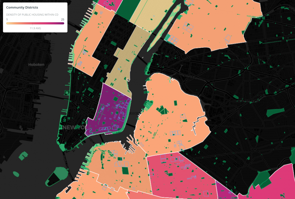
This map, made in Carto, is an exploration of the relationship between public space and public housing in NYC. By examining the area and frequency of these dynamics within Community Districts (CDs), I illustrate the stark differences in NYC’s realized development priorities, highlighting impact on a hyperlocal scale in novel ways.
Click here to explore the map on Carto.
See the accompanying report here.
My decision to focus on CDs represents a departure from my typical research focus. This project can be explained by the amalgamation of my personal experience as an NYC resident of seven years, and my professional ontology.
The main questions I asked in this experiment are as follows:
What is the relationship between publicly accessible spaces and community districts? Which CDs have the highest density of public housing? Largest area of park space? What does a visual representation of public space and public housing reveal about New York City?