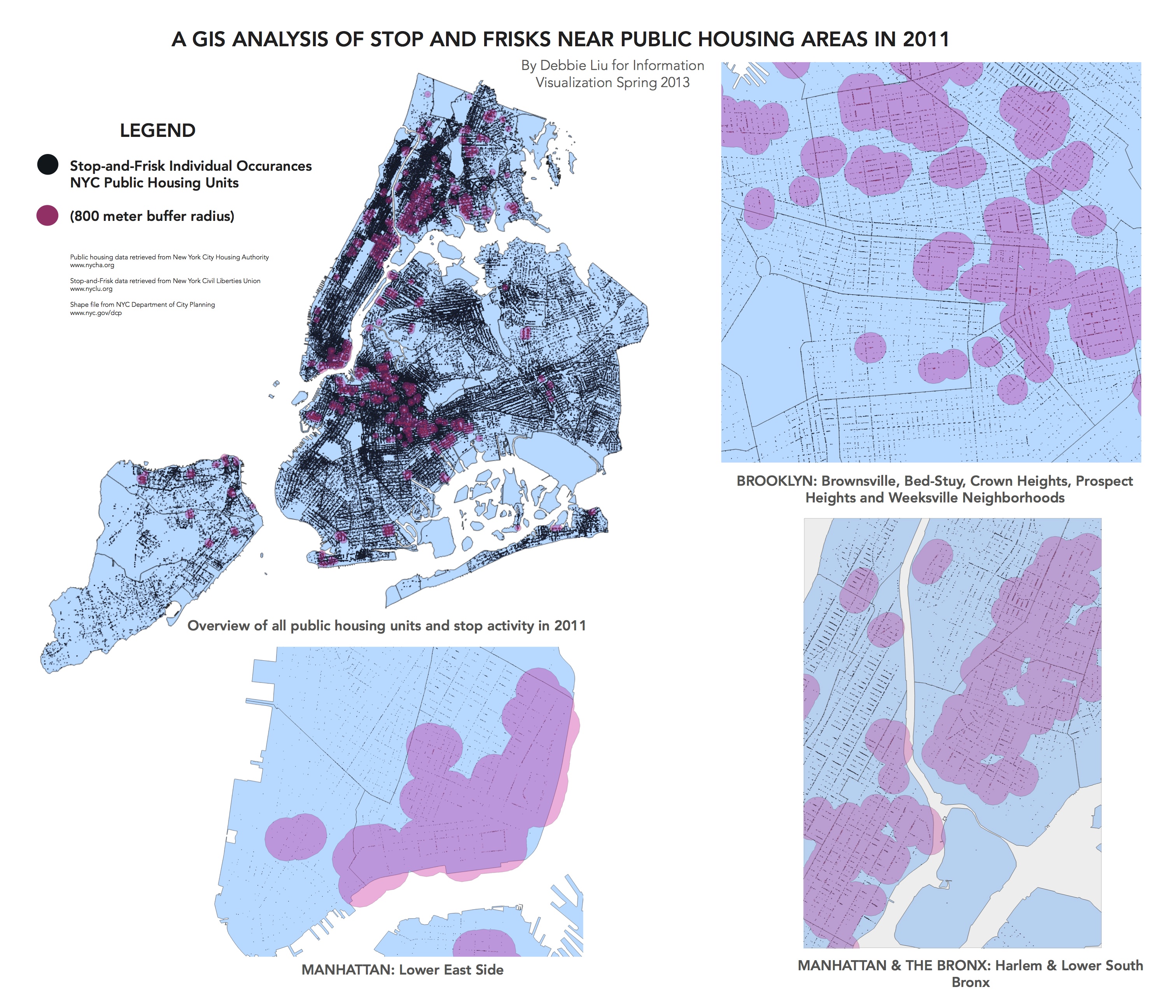
GIS Analysis of Stop and Frisks Near Public Housing Areas in 2011 May 10, 2013 In 2013 data GIS information visualization mapping NYC ← Previous post Next post →