Marc Molta
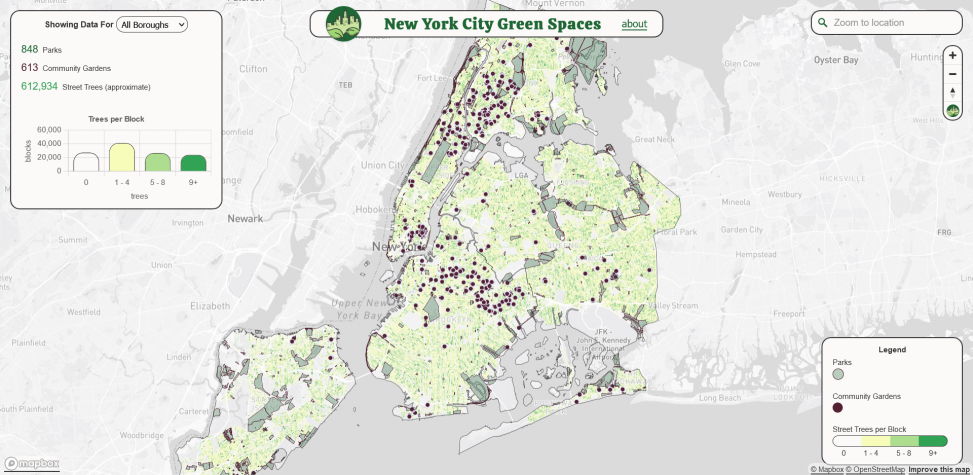
The New York City Green Spaces web map connects people to publicly accessible green spaces in New York City. Community Gardens, selected Parks Properties, and Block-level Street Trees paint a picture of active and passive greenery in the city.
Charts and figures create a summary story to contextualize explorations of the map data. Popups for parks and gardens give details on each site. The map is built on publicly accessible data from NYC’s Open Data portal. Data is filtered to only contain relevant columns and either queries directly from API sources, or is hosted as custom vector tiles on Mapbox Studio.
I have five years of experience designing and developing digital products including web maps, award-winning data visualizations, scroll-stories, and more. I am currently working as a freelance consultant helping clients ideate, design, and implement their products. I love working through problems and bringing projects to life through collaborative iteration.
Latest posts by Marc Molta (see all)
- Transportation Alternatives - May 1, 2023
- New York City Green Spaces - May 1, 2023