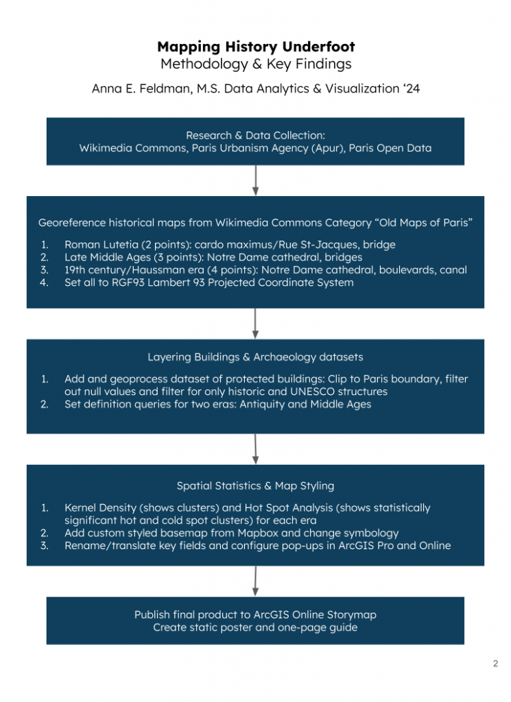
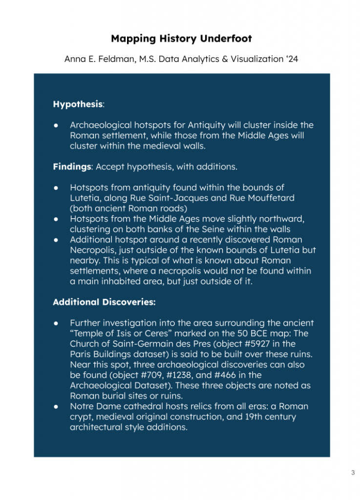
A research project in three parts, showing how the layering of multiple datasets over both the present-day map of Paris and selected historical maps can illuminate the timeline of the city’s settlement to the modern day through existing, tangible artifacts. This methodology might be used to scientifically discover and predict future archaeological findings via hot spot analysis or could simply serve as an exploratory or educational tool. It also presents a role that cultural institutions and digital humanities can take in preserving history and making it relevant through new technologies.
This research is visualized in three final products: A poster, a web map, and a storymap visualization.
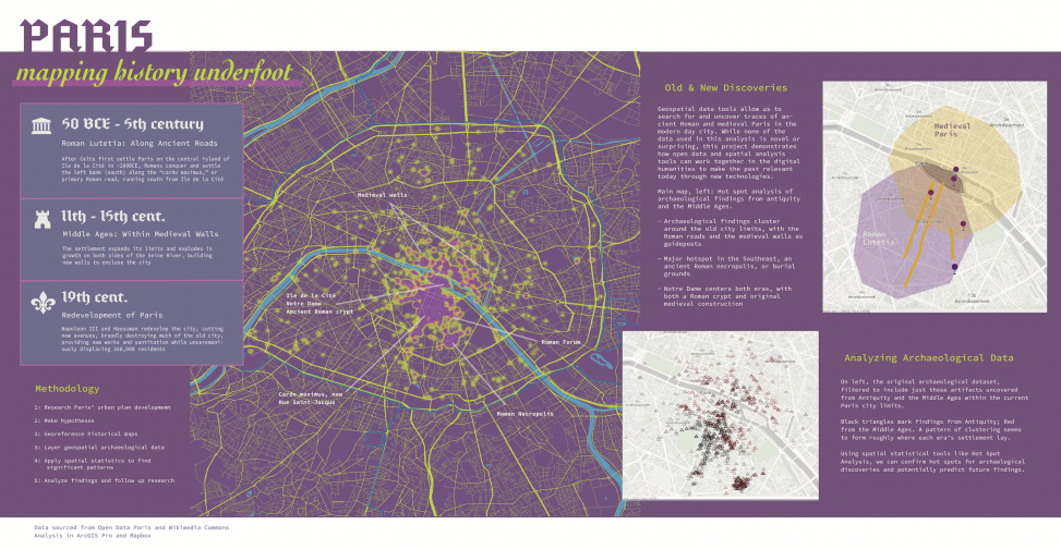
- View the poster above.
- Visit the Storymap here.
- Visit the ArcGIS Online Web Map here.
Brooklyn-based, D.C.-area native, translating my background in education policy and technology into a data analytics and visualization career focused on the digital humanities. Lover of museums, learning, and pretending to be a detective when conducting academic research.
M.S., Data Analytics & Visualization '24 // Spatial Analysis Advanced Certificate '24.