
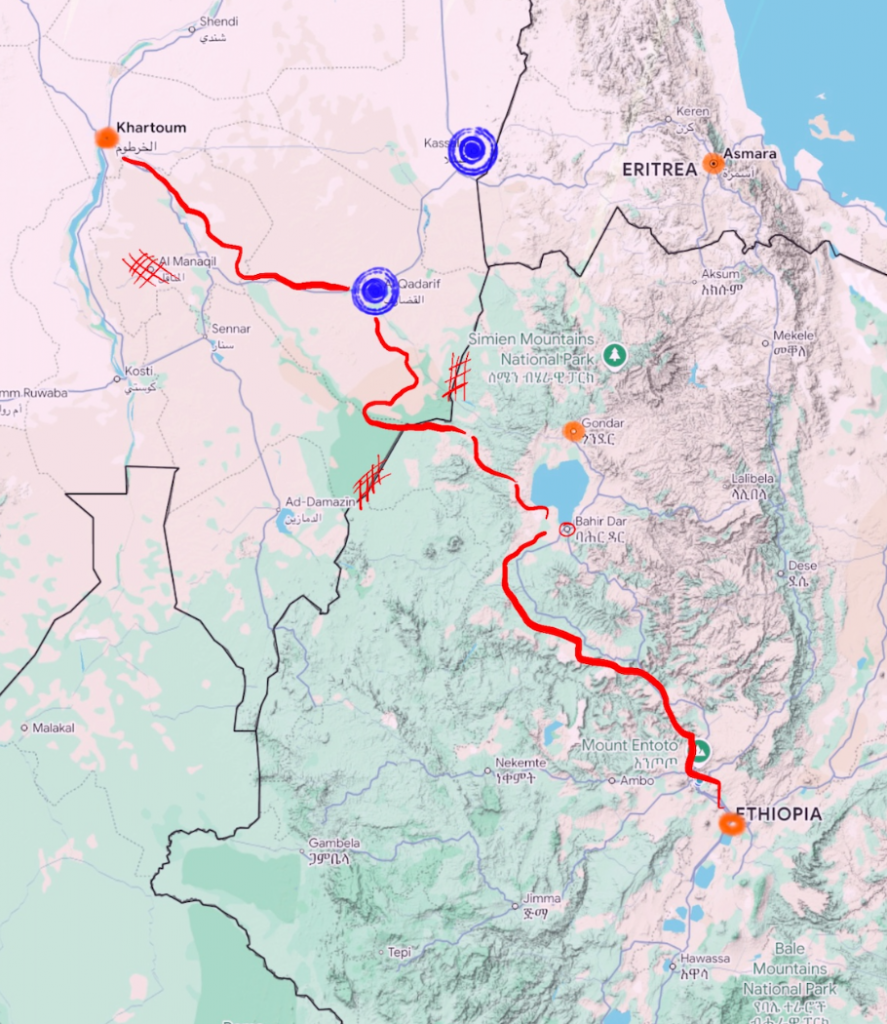
This project focuses on refugees from Ethiopia (and what is now Eritrea) in the late 80s to early 90s. Using conflict and elevation data along with testimonials from former refugees, a corridor was created to estimate.
This study operates of Part 1, and has led to the ongoing, Neighborhood Resurrection: Reunion Trajectories.
Find the Official Project Here
Historical Context:
For decades Khartoum, Sudan has been a site for refuge for millions of forcibly displaced peoples across Eastern and Northern Africa, despite being a country that has not had the proper support or infrastructure to resource such massive and consistent settlements.
Why so many refugees in 1989?
1989 was at the tail end of The Derg (1977-1991) [the period of authoritarianism], and several years following the infamous famine of the early 1980s. This made way for Qey Shibir (1970s), a political and cultural repression era that resulted in tens of thousands of students, journalists, artists, and former government and community leaders to be imprisoned or disappeared. Young men and women were expected to join the government army or face imprisonment.
Why 1989?
Uppsala Conflict Data Program (UCDP): earliest geocoded recordings for Africa begin at 1989
Read More


Latest posts by Makeda Tadesse (see all)
- Neighborhood Resurrection: Reunion Trajectories - May 12, 2026
- Neighborhood Corridor: Estimating Historical Refugee Routes - May 12, 2026