Tag: spatial analysis
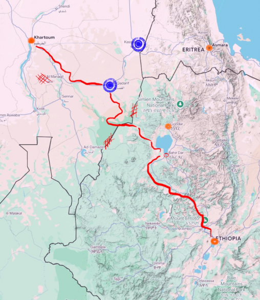
This project focuses on refugees from Ethiopia (and what is now Eritrea) in the late 80s to early 90s. Using conflict and elevation data along with testimonials from former refugees, a corridor was created to estimate.
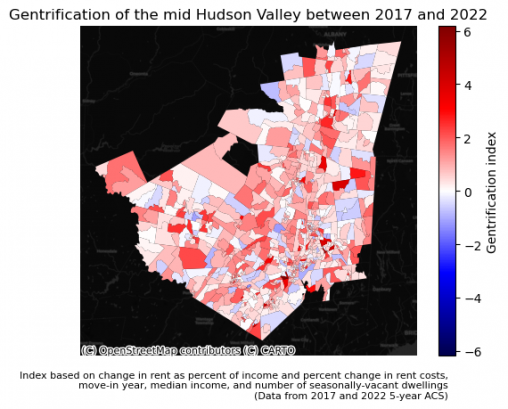
In recent years, and especially since the pandemic, farmers have increasingly been priced out of leasing or purchasing land in the Hudson Valley, and possibly elsewhere in the…