Tag: GIS
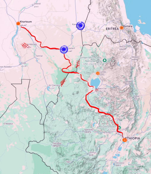
This project focuses on refugees from Ethiopia (and what is now Eritrea) in the late 80s to early 90s. Using conflict and elevation data along with testimonials from former refugees, a corridor was created to estimate.
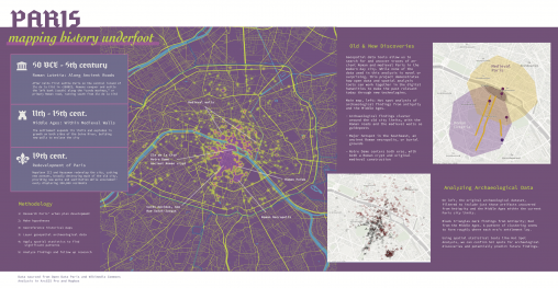
A research project in three parts, showing how the layering of multiple datasets over both the present-day map of Paris and selected historical maps can illuminate the timeline…
The New York Public Library’s Map Warper is an open-source program for integrating scanned copies of historical maps from the NYPL’s collections with digital maps. Our tutorial, selected…
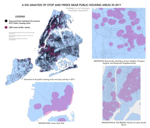
This mapping project examines stop and frisk data and public housing data.