Socially vulnerable communities suffer more from extreme heat and air pollution—two major environmental risk factors for cardiovascular and respiratory illnesses.
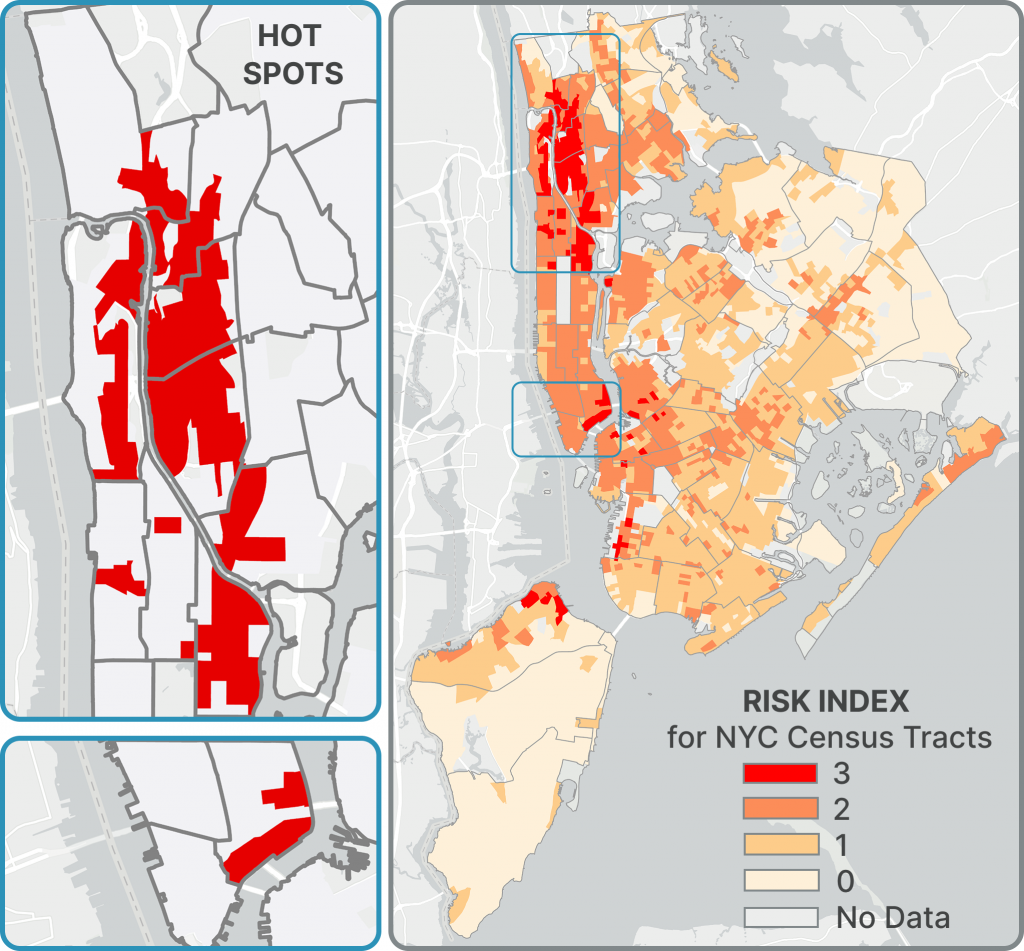
This project aims to create a risk index to identify New York City neighborhoods that suffer the most from these compounding vulnerabilities by using the Social Vulnerability Index, Urban Heat Island Effect Index, and PM2.5 concentration levels as proxies for social vulnerability, extreme heat, and air pollution.
Once the highest-risk neighborhoods were identified, a local clustering analysis was conducted to test whether the observed spatial clustering could be due to chance. Statistically significant highest-risk areas represent “hot spots” that require prioritization of public health intervention and prevention efforts.