Populated Places in the World with Carto
May 11, 2018 - All
Introduction
Populated place, known for the places of human settlement, is a geographical area constituting a city or town. In geography, statistics and archaeology, a settlement, locality or populated place is a community in which people live. A settlement can range in size from a small number of dwellings grouped together to the largest of cities with surrounding urbanized areas. Settlements may include hamlets, villages, towns and cities. The USGS (United States Geological Survey) definition of populated place is a “place or area with clustered or scattered buildings and a permanent human population (city, settlement, town, and village).” There are no legal boundaries, although there may be a corresponding ‘civil’ record, the boundaries of which may or may not match the perceived populated place.
With using the data set to understand the places density of human settlement, we can easily understand the population distribution in a visual map.
3 Visualizations that Inform/Inspired
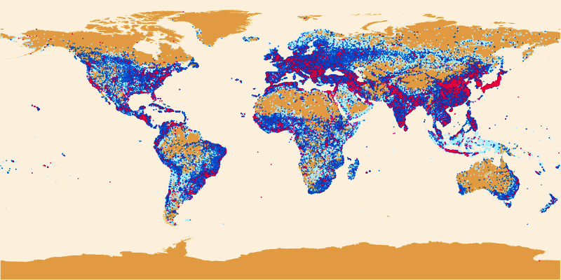
 Figure 1. Global Distribution of Populated Places tagged City/Town/Village in OpenStreetMap
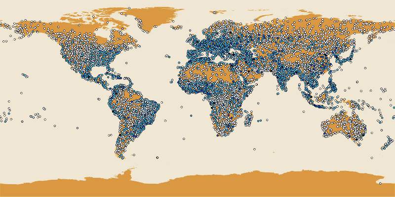 Figure 2. Importance rated Populated Places Worldwide.
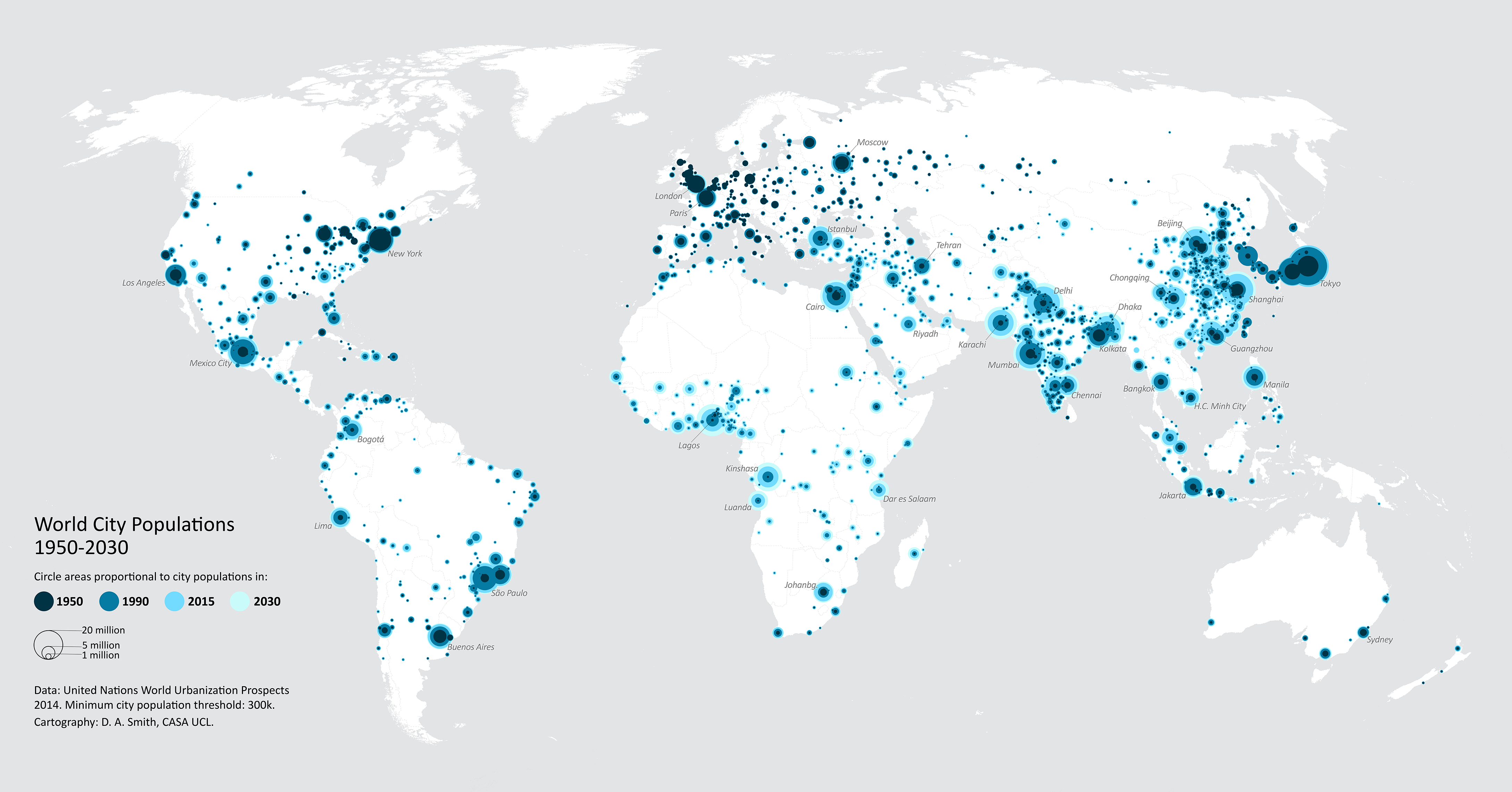 Figure 3. World City Populations 1950-2030.
Material, including software and datasets used in the lab
Carto: https://carto.com
QGIS 2.18: https://qgis.org
Dataset: http://www.naturalearthdata.com/downloads/10m-cultural-vectors/10m-populated-places
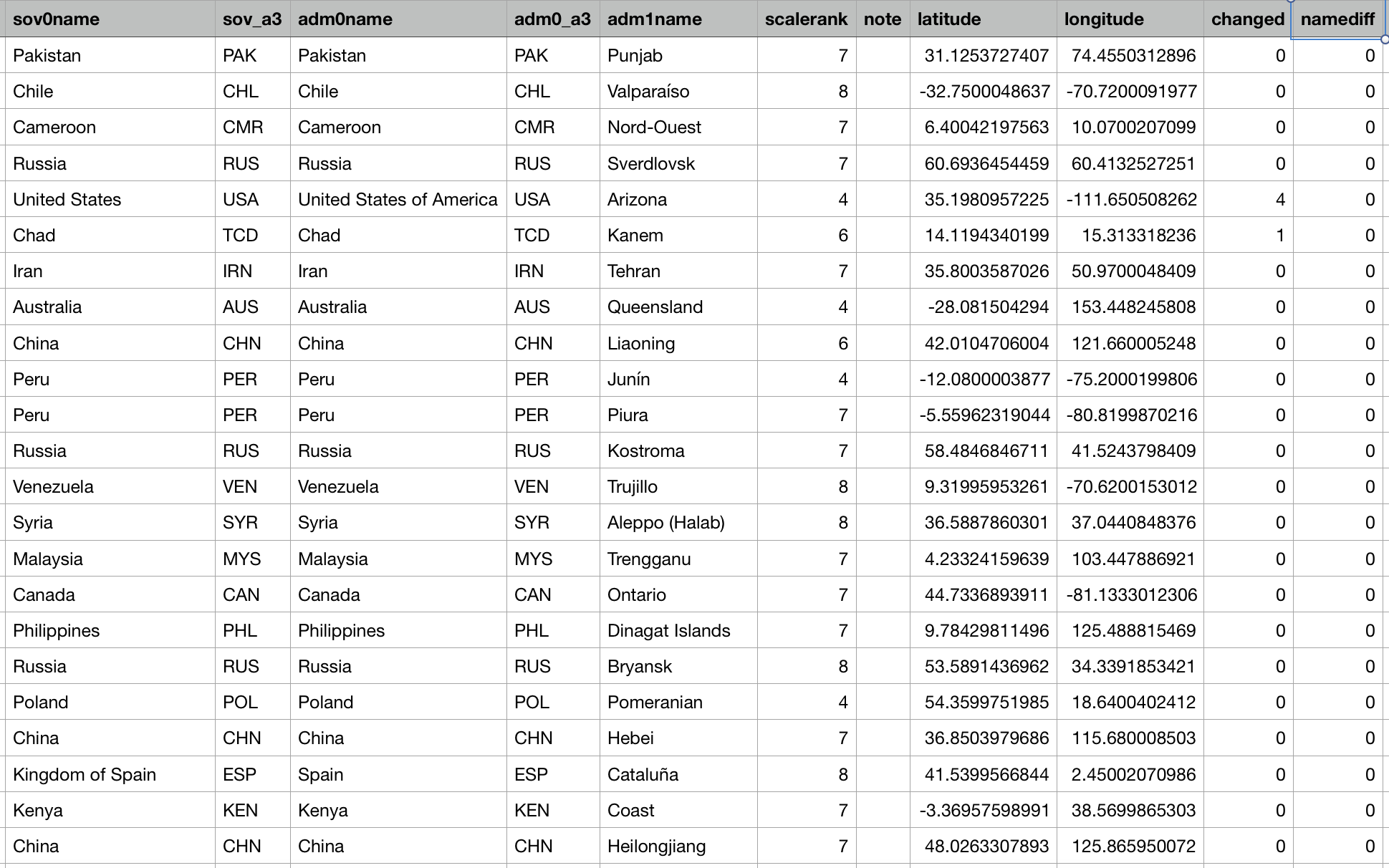 Figure 4. World Populated Places Datasets.
Methods used to Create Visualizations
To import dataset in Carto and QGIS, the map shows in different visual set. The color from light to dark shows the differentiation of the human density in different places from the worldwide views.
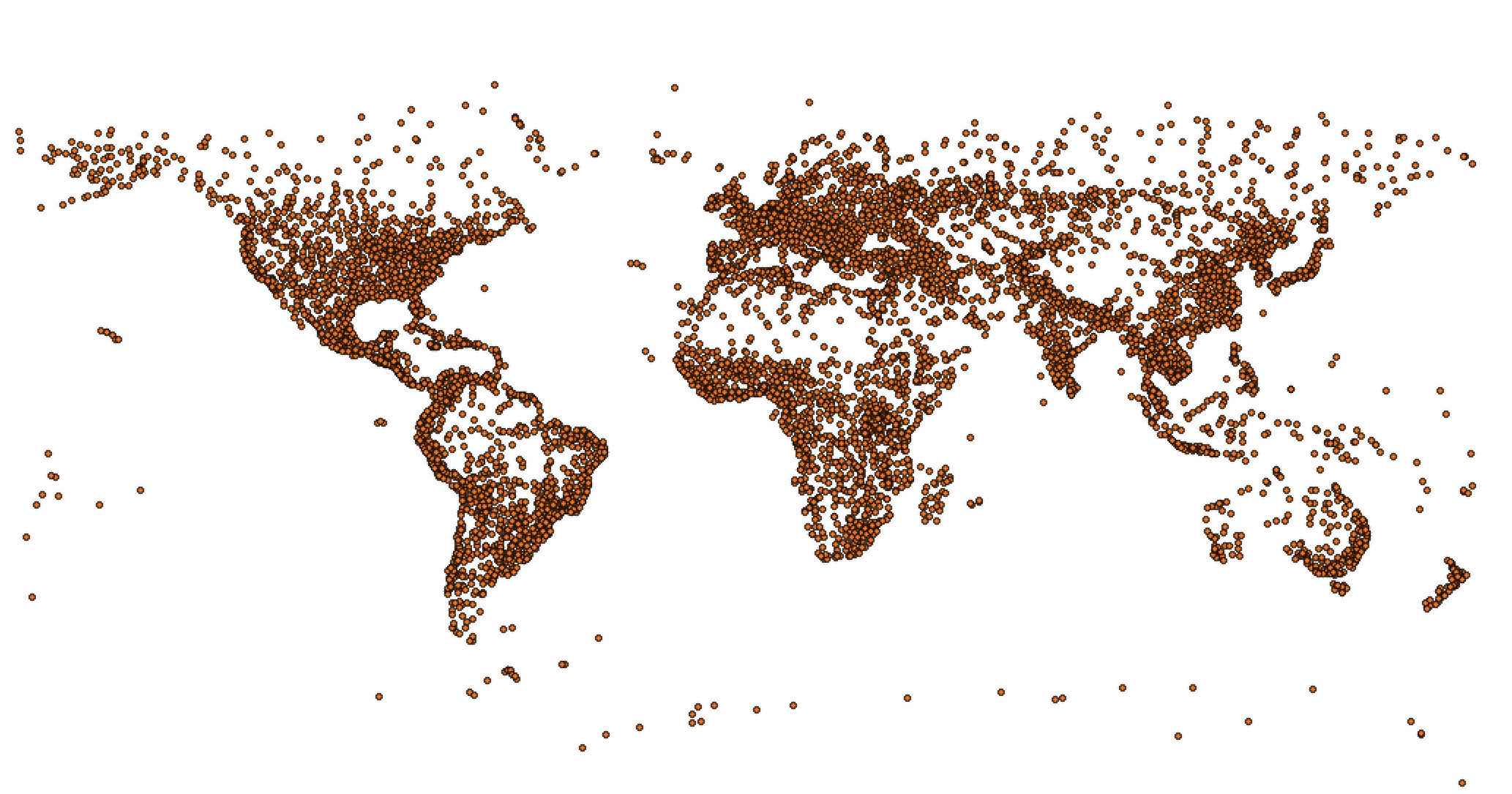 Figure 5. Visualizing Global Distribution of Populated Places in QGIS.
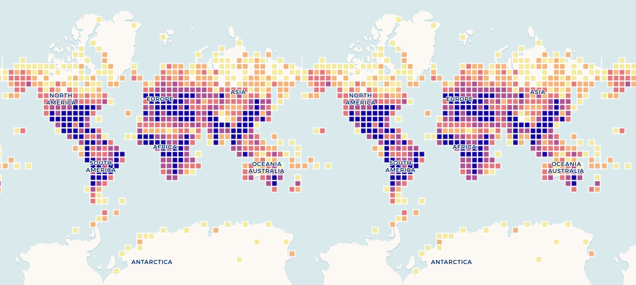 Figure 6. Visualizing Global Populated Places with color in Carto.
Results and Future Directions
With the growing population in big cities, we need to recreate the smart ecosystem in one certain area. Considering sustainability questions like how do we ensure that cities will be healthy and safe places for people to live? How will we absorb the costs of renewable resources as we implement the new global goals for reducing carbon emissions? What breakthroughs are on the horizon to transform our use of energy and power?
We have to think of the best ways to plan, facilitate, and implement development: since our institutions capable of managing the growing demands of large, complex infrastructure and transportation, how will we finance the rising cost of new infrastructure, or will smart city technology lead to less expensive ways of meeting our infrastructure needs? The new urban environments enhance people’s ability to make a good living, and make people benefit as innovations like artificial intelligence, drones and robots permeate in the workplace.
References
https://carto.com
http://www.imagco.de/map
http://luminocity3d.org/WorldCity/#3/12.00/10.00
The post Populated Places in the World with Carto appeared first on Information Visualization.